Most racing cyclists like to talk about the best climbs in their area. There are books and newspaper articles a plenty about them: which is best, which is hardest, which is the steepest etc. Few racing cyclists like to compare the flatter roads they ride along, perhaps justifiably, they can be a bit boring. But in Wales there are 2 roads that vastly underrated because they dont hit the high percentages of the Gospel Pass or Black Mountain. Lets celebrate them here.
1. Sarn Helen: Ystradfellte to Heol Senni
Just to clarify, by flat roads I didnt mean that they had to be completely flat, nor that you might have to do some climbing to get them. Sarn Helen is a case in point.
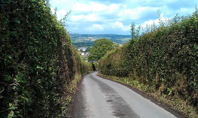
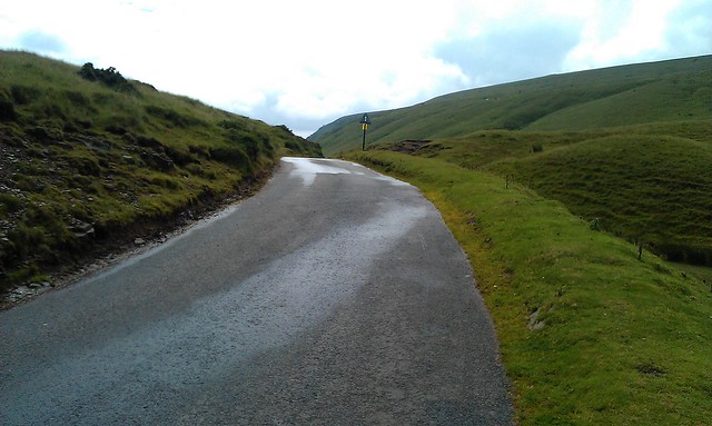
The climb starts at Aberllia which you can get to via Pontneddfechan or the Penderyn road. Looking at the OS map, the two arrows indicate steepness, but its not that bad. Once at the cattle grid, prepare for some breathtaking scenery.
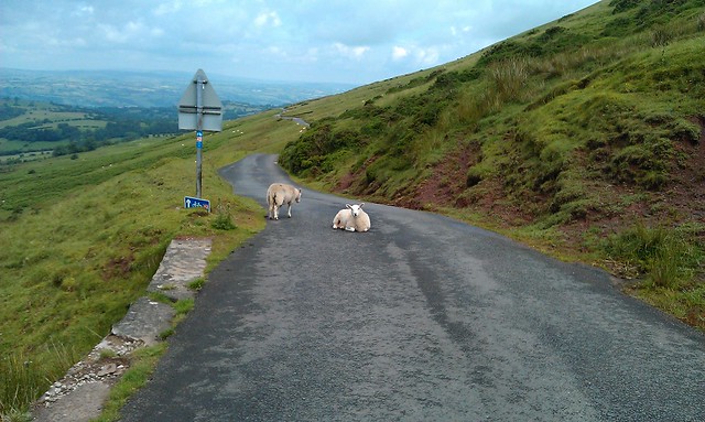
Its difficult to know which way to look: backwards, sideways or onwards. The road gradually climbs up through this glacial landscape, but only approaching a climb towards the top. Looking back you can see the Neath valley, to the side the stream and the Bronze age obelisk and the steep sided U-shaped valley. Then once at the top of the red sandstone escarpment, the view onto Defynnog is stunning, either from the top, the bottom or halfway. Just watch out for the sheep as you descend.
View Larger Map
2. Rhayader to Cwmystywth
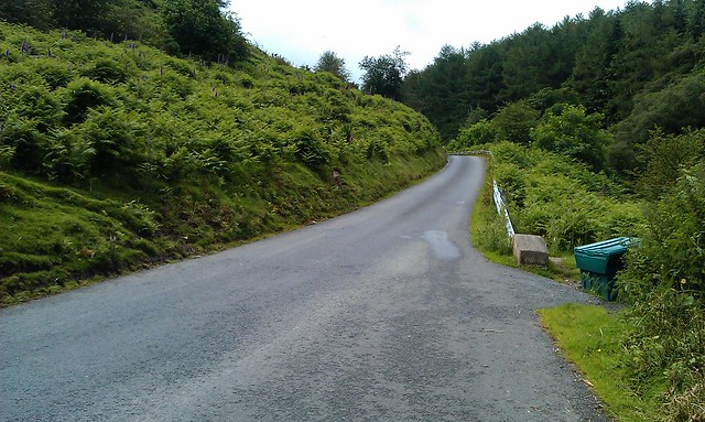
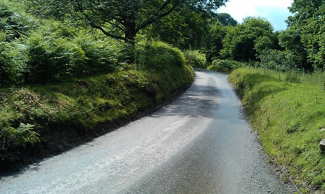
Another road with a climb to start with, but its not the climb that's of note, but the scenary once on top. The road twists and turns along side a rock strewn barren landscape. There's no steep valley sides to protect from the wind: its a real moonscape. After a while of this you suddenly plunge into a lush green valley only to come across a derelict former lead mine.
View Larger Map
Sunday, 22 July 2012
Monday, 16 July 2012
The Gospel Pass: Wales' Highest Road
Where's the highest road in Wales? The most common answer you'll hear is the Bwlch-y-Groes, up near Bala in North Wales. This is wrong. The answer is in fact the Gospel Pass, a narrow road from Hay-on-Wye to Abergavenny. The Gospel Pass tops out around 551m and the Bwlch-y-Groes around 544m depending on where you look (the altitudes vary on Strava and OS maps).
One wonders why this mistake is made so often? Is it because there's always something strange about the kinds of borderlands that the Gospel Pass finds itself in? Never quite in England, the road flirts with Englishness as it climbs up to Lord Herefordshire's Knob. It even starts out in the "independent" state of Hay-on-Wye. Perhaps its this not quite Welsh, not quite English status that leads many to overlook it in favour of the much more Welsh sounding Bwlch-y-Groes. After all, its in North Wales, it must be hilly up there, right?
The two climbs differ in other respects. The southern side of the Bwlch-y-Groes is horrendously steep. Littered with arrows on OS maps, symbols that tell most sane cyclists: find another road. But it is quite short: just 2.5km but with an average gradient of 13.5%. Vertically you climb 356m.
The Gospel Pass is a different animal. Longer, higher and shallower. At just over 5 miles, the climb is an average of 5.5% - equivalent to some of the other classic climbs in South Wales such as the Bwlch and Rhigos. Vertically it climbs 456 metres - only just surpassed by the longer Machynlleth mountain road.
But the gradient on the Gospel pass constantly changes, lots of up, some flat and even some down. Its hard to pace your effort, and the variation means there are some steep sections unlike the constant gradients of say the Rhigos.

An innocuous start...
The climb divides neatly into three sections. The first might be considered undulating rather than a serious climb. Leaving the junction in Hay, the road begins climbing gradually, pitching up past a dairy farm where the road surface is poor, before settling down into an uneven rhythm. A downhill section around a hairpin has you wondering whether this road really is going uphill, before a short steep pitch reminds you that it is.
One of the early steep sections, but not really climbing yet
There is no real view of where you are headed and another flat section sows more doubt that you are going the wrong way. Its confusing - this is the borderlands, remember. But then you reach the corner, and things start to become clear.

The Corner...
The corner marks the start of the second section of the climb. This is the steepest section that takes you out on to the common. There's not much to say about this section: its steep and hard. There are a couple of cattle grids, and if it has been raining the road will be slippery making climbing out of the saddle tricky.
Steep bits
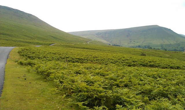
Slowly, the foxgloves and ferns on the side of the road begin to make way for a more desolate landscape which marks the start of the third stage. By now most of the clmbing is done.
The pass snaking its way up. On the right, Lord Herefordshire's Knob...
There are a couple of short steep sections to come, but once onto the common the rest of the road can be seen snaking away to the summit. If the road isnt too obstructed by sheep, then this section can be taken in the big ring. Until the very top, where the final 500 metres reminds you that you have been riding over Wales' highest road.
The top...
The descent - either back down to Hay or on to Capel y Ffin - is extremely technical and dangerous: its a single track road with walkers, cars and sheep to avoid. Best stop and take photos on the way down like I did, rather than think its the Tour de France.
Take care on the descent...
And that's the Gospel Pass: an ambiguous climb, but all the more interesting for it.
One wonders why this mistake is made so often? Is it because there's always something strange about the kinds of borderlands that the Gospel Pass finds itself in? Never quite in England, the road flirts with Englishness as it climbs up to Lord Herefordshire's Knob. It even starts out in the "independent" state of Hay-on-Wye. Perhaps its this not quite Welsh, not quite English status that leads many to overlook it in favour of the much more Welsh sounding Bwlch-y-Groes. After all, its in North Wales, it must be hilly up there, right?
The two climbs differ in other respects. The southern side of the Bwlch-y-Groes is horrendously steep. Littered with arrows on OS maps, symbols that tell most sane cyclists: find another road. But it is quite short: just 2.5km but with an average gradient of 13.5%. Vertically you climb 356m.
The Gospel Pass is a different animal. Longer, higher and shallower. At just over 5 miles, the climb is an average of 5.5% - equivalent to some of the other classic climbs in South Wales such as the Bwlch and Rhigos. Vertically it climbs 456 metres - only just surpassed by the longer Machynlleth mountain road.
But the gradient on the Gospel pass constantly changes, lots of up, some flat and even some down. Its hard to pace your effort, and the variation means there are some steep sections unlike the constant gradients of say the Rhigos.
An innocuous start...
The climb divides neatly into three sections. The first might be considered undulating rather than a serious climb. Leaving the junction in Hay, the road begins climbing gradually, pitching up past a dairy farm where the road surface is poor, before settling down into an uneven rhythm. A downhill section around a hairpin has you wondering whether this road really is going uphill, before a short steep pitch reminds you that it is.
One of the early steep sections, but not really climbing yet
There is no real view of where you are headed and another flat section sows more doubt that you are going the wrong way. Its confusing - this is the borderlands, remember. But then you reach the corner, and things start to become clear.
The Corner...
The corner marks the start of the second section of the climb. This is the steepest section that takes you out on to the common. There's not much to say about this section: its steep and hard. There are a couple of cattle grids, and if it has been raining the road will be slippery making climbing out of the saddle tricky.
Steep bits
Slowly, the foxgloves and ferns on the side of the road begin to make way for a more desolate landscape which marks the start of the third stage. By now most of the clmbing is done.
The pass snaking its way up. On the right, Lord Herefordshire's Knob...
There are a couple of short steep sections to come, but once onto the common the rest of the road can be seen snaking away to the summit. If the road isnt too obstructed by sheep, then this section can be taken in the big ring. Until the very top, where the final 500 metres reminds you that you have been riding over Wales' highest road.
The top...
The descent - either back down to Hay or on to Capel y Ffin - is extremely technical and dangerous: its a single track road with walkers, cars and sheep to avoid. Best stop and take photos on the way down like I did, rather than think its the Tour de France.
Take care on the descent...
And that's the Gospel Pass: an ambiguous climb, but all the more interesting for it.
Subscribe to:
Posts (Atom)