Thursday, 15 August 2013
Its been a while, but its ON!
So, the Ventoux is on. And Alpe d'huez. And the Col du Semnoz. And even the Col de la Forclaz.
We leave on the 14th September, flying to Marseille before driving over to Bedoin. Depending on the time and the weather I may ride up the Ventoux in the evening. Otherwise, its going to be a long day on Sunday: Bedoin to Malaucène and back again. I had thought about coming back up from Sault to back it three ascensions, but by all accounts thats a relatively boring route and repeats the top section from Bedoin. Besides, there are more challenges to come...
Because of Easyjet's flight schedule getting back from Marseille was more difficult. If I had thought harder, we should have gone down to the Tourmalet and then flown back from Toulouse. But I didn't. Instead it occurred to me that I could ride up Alpe d'huez and then the Semnoz outside of Annecy. Ive done the Alpe before in an hour (when I was young and carefree), and seen the Semnoz from time spent in Annecy. And the Col de la Forclaz on the other side of the lake is also on the list.
All of these plans are weather dependent - the primary aim is Ventoux and if its stormy then plans might have to change. Ironically the reason I am going in September is because my Directeur Sportif (Dad to me) advised against the heat of July. Fine. Only July in south Wales turned out to be one of the hottest in a long time. It wouldn't have made much difference. And it means I have to train for another 6 weeks as well...
At least the training is going well though. This year I have had the added incentive of using a power meter which measures the power (in watts) generated as I ride. Its a fascinating piece of kit and makes you think not just about your training, but how you actually ride. You can see all the training Ive been doing on Strava
Dont forget to donate either.


Sunday, 22 July 2012
Best Roads in Wales
Most racing cyclists like to talk about the best climbs in their area. There are books and newspaper articles a plenty about them: which is best, which is hardest, which is the steepest etc. Few racing cyclists like to compare the flatter roads they ride along, perhaps justifiably, they can be a bit boring. But in Wales there are 2 roads that vastly underrated because they dont hit the high percentages of the Gospel Pass or Black Mountain. Lets celebrate them here.
1. Sarn Helen: Ystradfellte to Heol Senni
Just to clarify, by flat roads I didnt mean that they had to be completely flat, nor that you might have to do some climbing to get them. Sarn Helen is a case in point.
The climb starts at Aberllia which you can get to via Pontneddfechan or the Penderyn road. Looking at the OS map, the two arrows indicate steepness, but its not that bad. Once at the cattle grid, prepare for some breathtaking scenery.
Its difficult to know which way to look: backwards, sideways or onwards. The road gradually climbs up through this glacial landscape, but only approaching a climb towards the top. Looking back you can see the Neath valley, to the side the stream and the Bronze age obelisk and the steep sided U-shaped valley. Then once at the top of the red sandstone escarpment, the view onto Defynnog is stunning, either from the top, the bottom or halfway. Just watch out for the sheep as you descend.
View Larger Map 2. Rhayader to Cwmystywth Another road with a climb to start with, but its not the climb that's of note, but the scenary once on top. The road twists and turns along side a rock strewn barren landscape. There's no steep valley sides to protect from the wind: its a real moonscape. After a while of this you suddenly plunge into a lush green valley only to come across a derelict former lead mine.
View Larger Map
View Larger Map 2. Rhayader to Cwmystywth Another road with a climb to start with, but its not the climb that's of note, but the scenary once on top. The road twists and turns along side a rock strewn barren landscape. There's no steep valley sides to protect from the wind: its a real moonscape. After a while of this you suddenly plunge into a lush green valley only to come across a derelict former lead mine.
View Larger Map
Monday, 16 July 2012
The Gospel Pass: Wales' Highest Road
Where's the highest road in Wales? The most common answer you'll hear is the Bwlch-y-Groes, up near Bala in North Wales. This is wrong. The answer is in fact the Gospel Pass, a narrow road from Hay-on-Wye to Abergavenny. The Gospel Pass tops out around 551m and the Bwlch-y-Groes around 544m depending on where you look (the altitudes vary on Strava and OS maps).
One wonders why this mistake is made so often? Is it because there's always something strange about the kinds of borderlands that the Gospel Pass finds itself in? Never quite in England, the road flirts with Englishness as it climbs up to Lord Herefordshire's Knob. It even starts out in the "independent" state of Hay-on-Wye. Perhaps its this not quite Welsh, not quite English status that leads many to overlook it in favour of the much more Welsh sounding Bwlch-y-Groes. After all, its in North Wales, it must be hilly up there, right?
The two climbs differ in other respects. The southern side of the Bwlch-y-Groes is horrendously steep. Littered with arrows on OS maps, symbols that tell most sane cyclists: find another road. But it is quite short: just 2.5km but with an average gradient of 13.5%. Vertically you climb 356m.
The Gospel Pass is a different animal. Longer, higher and shallower. At just over 5 miles, the climb is an average of 5.5% - equivalent to some of the other classic climbs in South Wales such as the Bwlch and Rhigos. Vertically it climbs 456 metres - only just surpassed by the longer Machynlleth mountain road.
But the gradient on the Gospel pass constantly changes, lots of up, some flat and even some down. Its hard to pace your effort, and the variation means there are some steep sections unlike the constant gradients of say the Rhigos.

An innocuous start...
The climb divides neatly into three sections. The first might be considered undulating rather than a serious climb. Leaving the junction in Hay, the road begins climbing gradually, pitching up past a dairy farm where the road surface is poor, before settling down into an uneven rhythm. A downhill section around a hairpin has you wondering whether this road really is going uphill, before a short steep pitch reminds you that it is.
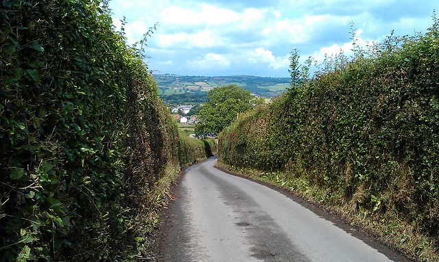
One of the early steep sections, but not really climbing yet
There is no real view of where you are headed and another flat section sows more doubt that you are going the wrong way. Its confusing - this is the borderlands, remember. But then you reach the corner, and things start to become clear.

The Corner...
The corner marks the start of the second section of the climb. This is the steepest section that takes you out on to the common. There's not much to say about this section: its steep and hard. There are a couple of cattle grids, and if it has been raining the road will be slippery making climbing out of the saddle tricky.
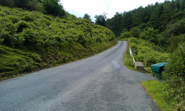
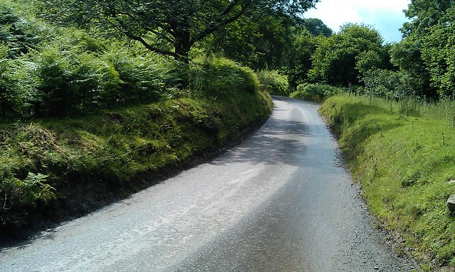
Steep bits
Slowly, the foxgloves and ferns on the side of the road begin to make way for a more desolate landscape which marks the start of the third stage. By now most of the clmbing is done.
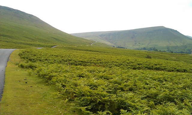
The pass snaking its way up. On the right, Lord Herefordshire's Knob...
There are a couple of short steep sections to come, but once onto the common the rest of the road can be seen snaking away to the summit. If the road isnt too obstructed by sheep, then this section can be taken in the big ring. Until the very top, where the final 500 metres reminds you that you have been riding over Wales' highest road.
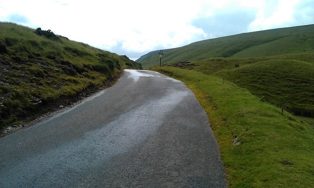
The top...
The descent - either back down to Hay or on to Capel y Ffin - is extremely technical and dangerous: its a single track road with walkers, cars and sheep to avoid. Best stop and take photos on the way down like I did, rather than think its the Tour de France.
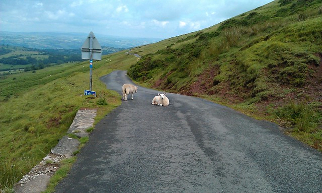
Take care on the descent...
And that's the Gospel Pass: an ambiguous climb, but all the more interesting for it.
One wonders why this mistake is made so often? Is it because there's always something strange about the kinds of borderlands that the Gospel Pass finds itself in? Never quite in England, the road flirts with Englishness as it climbs up to Lord Herefordshire's Knob. It even starts out in the "independent" state of Hay-on-Wye. Perhaps its this not quite Welsh, not quite English status that leads many to overlook it in favour of the much more Welsh sounding Bwlch-y-Groes. After all, its in North Wales, it must be hilly up there, right?
The two climbs differ in other respects. The southern side of the Bwlch-y-Groes is horrendously steep. Littered with arrows on OS maps, symbols that tell most sane cyclists: find another road. But it is quite short: just 2.5km but with an average gradient of 13.5%. Vertically you climb 356m.
The Gospel Pass is a different animal. Longer, higher and shallower. At just over 5 miles, the climb is an average of 5.5% - equivalent to some of the other classic climbs in South Wales such as the Bwlch and Rhigos. Vertically it climbs 456 metres - only just surpassed by the longer Machynlleth mountain road.
But the gradient on the Gospel pass constantly changes, lots of up, some flat and even some down. Its hard to pace your effort, and the variation means there are some steep sections unlike the constant gradients of say the Rhigos.
An innocuous start...
The climb divides neatly into three sections. The first might be considered undulating rather than a serious climb. Leaving the junction in Hay, the road begins climbing gradually, pitching up past a dairy farm where the road surface is poor, before settling down into an uneven rhythm. A downhill section around a hairpin has you wondering whether this road really is going uphill, before a short steep pitch reminds you that it is.
One of the early steep sections, but not really climbing yet
There is no real view of where you are headed and another flat section sows more doubt that you are going the wrong way. Its confusing - this is the borderlands, remember. But then you reach the corner, and things start to become clear.
The Corner...
The corner marks the start of the second section of the climb. This is the steepest section that takes you out on to the common. There's not much to say about this section: its steep and hard. There are a couple of cattle grids, and if it has been raining the road will be slippery making climbing out of the saddle tricky.
Steep bits
Slowly, the foxgloves and ferns on the side of the road begin to make way for a more desolate landscape which marks the start of the third stage. By now most of the clmbing is done.
The pass snaking its way up. On the right, Lord Herefordshire's Knob...
There are a couple of short steep sections to come, but once onto the common the rest of the road can be seen snaking away to the summit. If the road isnt too obstructed by sheep, then this section can be taken in the big ring. Until the very top, where the final 500 metres reminds you that you have been riding over Wales' highest road.
The top...
The descent - either back down to Hay or on to Capel y Ffin - is extremely technical and dangerous: its a single track road with walkers, cars and sheep to avoid. Best stop and take photos on the way down like I did, rather than think its the Tour de France.
Take care on the descent...
And that's the Gospel Pass: an ambiguous climb, but all the more interesting for it.
Tuesday, 8 May 2012
Pen-y-coedcae: The Poggio of South Wales
Its different in som many ways, but in my mind the climb to Pen-y-coedcae above Ponty reminds me so much of the Poggio - the famous climb at the end of Milan San Remo.
Its not so much the climb: from Ponty its much steeper than the Poggio, from the other side maybe its similar but you dont get the sense of being on the side of a mountain as you do climbing out of Ponty. Really its just the bend through the houses in Pen-y-coedcae - a sharp right hander which marks the start of the vertiginuous descent into Ponty. Even this is different - on the Poggio its a sharp left hander and then the descent is stacked with hairpins: the main obstacle on the descent into Ponty is when you start to come in to the houses, just as it gets really steep. And of course, Ponty is no San Remo.
I bet we all have these little imaginings on our rides of places being similar to those landmarks and monuments of cycling we see in the classics and the tours. I bet some of you even rename local hills the "col de so and so" in recognition of a real cycling landscape. No doubt its why thousands will be coming to ride the Dragon ride in a couple of weeks in South Wales - not so much for a physical challenge, but because the roads over the Rhigos and Bwlch are the closest to what we think we'd find in the Alps and the Pyrenees. They are not. But we can dream they are.
Anyway, here's my ride tonight. Went hard up the drag out of Ponty twice, and then up over the Graig through Pen-y-coedcae. I took it relatively easy on low gears so I reckon I can take some time out of that next time. But for the moment, Im still King of the Mountains on Strava.
Subscribe to:
Posts (Atom)